
Real-Time Traffic Information for Jacksonville Florida |
Stay ahead with live traffic updates and current Florida traffic conditions |
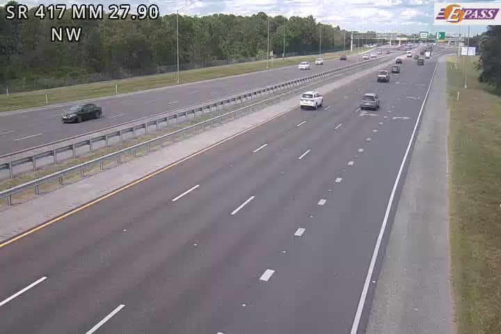
For anyone navigating the roads of Northeast Florida, having access to real-time traffic information is no longer a luxury — it's a necessity.
Jacksonville is one of the largest cities by land area in the continental United States, and its sprawling road network means that a single incident on Interstate 95 or Interstate 10 can trigger a ripple effect that stretches for miles.
Live traffic updates give drivers the power to react before they're already stuck, rerouting around accidents, construction zones, and unexpected slowdowns before precious time is lost.
The difference between a smooth commute and a frustrating gridlock often comes down to who has the right information — and who doesn't.
Current Florida traffic conditions across the Jacksonville metro are closely monitored through the state's advanced traveler information system, which tracks congestion events, lane closures, and road incidents in real time across major corridors.
Commuters crossing the St. Johns River bridges or navigating the busy interchange at I-295 know all too well how quickly conditions can deteriorate during peak morning and evening hours.
Road construction activity in areas like Jacksonville Heights and along US-1 continues to create shifting traffic patterns that can catch unprepared drivers off guard.
Staying informed isn't just about saving time — it's about staying safe on some of Florida's most heavily traveled roadways.
Officials confirm that live traffic cameras and incident reporting tools now cover a wide range of key routes throughout Duval County and into neighboring St. Johns County, giving commuters a more complete picture of road conditions across the region.
According to recent reports, crashes on corridors like I-95 southbound near the St. Johns County line remain among the most common sources of significant delays, reinforcing why real-time monitoring tools are so valuable for daily drivers.
What has changed in recent years is the accessibility of this information — once limited to radio updates, it's now available instantly on mobile devices, in-car navigation systems, and dedicated traffic platforms.
Drivers can now receive customized alerts for specific routes, allowing them to plan ahead rather than react in the moment.
Florida's Department of Transportation continues to expand its real-time data infrastructure, with live speed tracking, camera feeds, and incident notifications serving as core features of the statewide system.
For Jacksonville residents, that kind of timely, hyperlocal awareness can be the difference between arriving on time and losing an hour to traffic they never saw coming.
Whether you're heading into downtown, crossing into Clay County, or navigating the growing southern corridors, keeping tabs on live traffic updates before you leave — and during your drive — is the smartest move any Jacksonville commuter can make. |
25 Comments
Join the conversation
Losing an hour to traffic you never saw coming is the worst feeling. Happened to me on I95 last week
I tell everyone to download a live traffic app before they even think about driving in this city
My commute from Jacksonville Heights takes twice as long since construction started. The detours are confusing too
FDOT expanding the real time data is great but they also need to just fix some of these roads
The downtown commute is honestly not that bad if you go early. After 730 though forget it
Its wild that just a few years ago we were dependent on radio for this. Now its all on your watch if you want it
I missed a job interview because of an I295 backup nobody warned me about. Never again without checking first
People moving here from smaller cities have no idea what they are getting into with Jacksonville traffic
The customized route alerts are a game changer. Set it up once and forget about it basically
Good to hear they are expanding the camera coverage into Duval and St Johns. About time honestly
I got a job in St Johns County last year and that commute on I95 southbound has aged me ten years
The in car navigation systems still lag behind the actual traffic apps on your phone in my experience
Wish more people would actually use these tools instead of just sitting in traffic and honking
Clay County folks already know the pain of those southern corridors. Every afternoon is an adventure
I started checking the FDOT camera feeds before I leave the house and it honestly changed my mornings
The ripple effect they mention is real. One wreck on I10 and somehow my neighborhood street backs up too
Jacksonville Heights construction has been brutal lately. Nobody talks about it enough
Radio traffic updates feel so outdated now. By the time they say something the jam is already 3 miles long
My husband found out about a bad wreck on I95 from a traffic alert and saved himself like 45 minutes last Tuesday
Crossing the St Johns River bridges during rush hour is a whole different kind of stress
The construction on US-1 has been going on forever. Those shifting lanes catch people off guard every week
Jacksonville being one of the biggest cities by land area is exactly why traffic apps matter more here than most places
Waze has saved me so many times on the 295 interchange. Cant imagine driving without it now
I95 near the St Johns County line is always a mess. Every single morning without fail.
The traffic is the first thing im worried about in the mornings